Results
- Index of names for the Survey of Lands for the Welland Canal Company. The index includes names for people whos lands were surveyed on the line of the canal. The index also includes a very basic geogrIndex of names for the Survey of Lands for the Welland Canal …
- This is an index of all the names contained within the Survey of Lands. The names are listed in alphabetical order and are paired with page numbers where more information can be found on the individuThis is an index of all the names contained within the Survey …
- Index of names for the Welland Canal Company's Survey of Land book, 1826. Includes persons name, land cultivated, uncultivated, total land and remarks. The remarks noted include; who surveyed the lanIndex of names for the Welland Canal Company's Survey of Land book, …
- This is an index of all the names contained within the Survey of Lands. The names are listed in alphabetical order and are paired with page numbers where more information can be found on the individuThis is an index of all the names contained within the Survey …
- A detailed description of land purchased by the Welland Canal Company from Jacob I. Ball for the construction of the first Welland Canal. Noteable features include; line between Ker and Shaver properA detailed description of land purchased by the Welland Canal Company from …
- Survey map and description of Jacob Neff Sr.'s land created by The Welland Canal Company. Included is a written description of the land along with a drawing of the land. Noteable features include; caSurvey map and description of Jacob Neff Sr.'s land created by The …
- Survey map and description of James Gordon's land created by The Welland Canal Company. Included is a written description of the land along with a drawing of the land. The map contains a large pond aSurvey map and description of James Gordon's land created by The Welland …
- Survey map and description of William May Jr.'s land created by The Welland Canal Company. Included is a written description of the land along with a drawing of the land. The land is described as havSurvey map and description of William May Jr.'s land created by The …
- Survey map and description of Peter May's land created by The Welland Canal Company. Included is a written description of the land along with a drawing of the land. Noteable features include; a largeSurvey map and description of Peter May's land created by The Welland …
- Updated survey description of William May's land created by The Welland Canal Company. The land is now in the posession of Christian May as he was the heir for the property. The drawing for the propeUpdated survey description of William May's land created by The Welland Canal …
- Survey map and description of Robert Brown's land created by The Welland Canal Company. Included is a two page written description of the land along with a drawing of the land. Noteable features inclSurvey map and description of Robert Brown's land created by The Welland …
- Survey map and description of Robert Brown's land created by The Welland Canal Company. Included is a two page written description of the land along with a drawing of the land. Noteable features inclSurvey map and description of Robert Brown's land created by The Welland …
- Survey map and description of John Martindale's land created by The Welland Canal Company. Included is a written description of the land along with a drawing of the land. Noteable features include; pSurvey map and description of John Martindale's land created by The Welland …
- Survey map and description of Samuel Wood's land created by The Welland Canal Company. Included is a written description of the land along with a drawing of the land. The same description of the landSurvey map and description of Samuel Wood's land created by The Welland …
- See also record for page 36. The land was required for canal towpath and lock house.See also record for page 36. The land was required for canal …
- Survey map and description of Jesse Willson's land created by The Welland Canal Company. Included is a written description of the land along with a drawing of the land. Noteable features include; WelSurvey map and description of Jesse Willson's land created by The Welland …
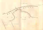
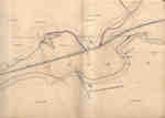
- Survey map of the Second Welland Canal created by the Welland Canal Company showing a portion of the Grantham Township near Port Dalhousie. Identified structures associated with the Canal include theSurvey map of the Second Welland Canal created by the Welland Canal …
- Survey map of the Second Welland Canal created by the Welland Canal Company showing a portion of the Grantham Township. Identified structures associated with the Canal include the floating tow path aSurvey map of the Second Welland Canal created by the Welland Canal …
- Survey map of the Second Welland Canal created by the Welland Canal Company showing a portion of the Grantham Township near Port Dalhousie. Identified structures associated with the Canal include theSurvey map of the Second Welland Canal created by the Welland Canal …
Brock Images are created and maintained by the Special Collections and Archives, James A. Gibson Library, Brock University.


